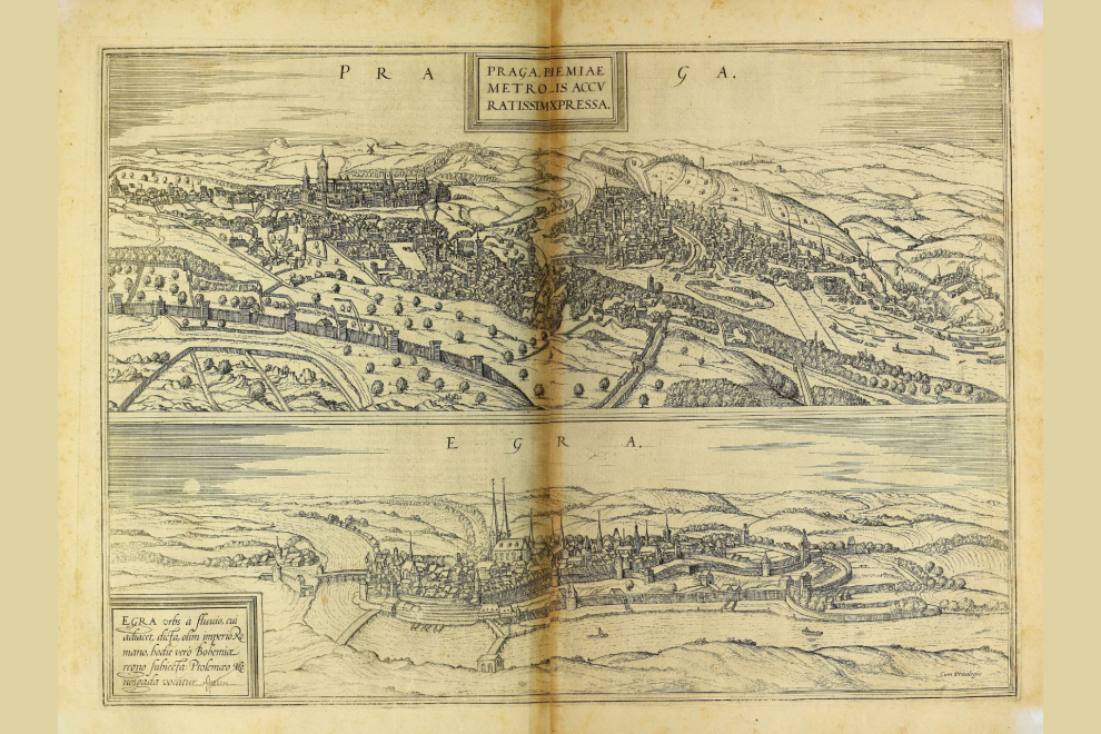
Ve dnech 17. až 19. září se v Praze uskuteční 19. ročník konference “Digital Approaches to Cartographic Heritage” (Digitální přístupy ke kartografickému dědictví).
Akci pořádá Komise pro digitální kartografické dědictví Mezinárodní kartografické asociace (ICA) ve spolupráci s Geografickou sekcí Přírodovědecké fakulty Univerzity Karlovy a laboratoří Carto-GeoLab Aristotelovy univerzity v Soluni. Konference se koná za podpory skupiny MAGIC (Map & Geoinformation Curators Group) a Výzkumného výboru Aristotelovy univerzity v Soluni.
Program se zaměří na témata spojená s digitalizací, analýzou a zpřístupněním historických map a geografických dat.
Témata příspěvků
- Digitalizace – Georeference
- Analýza obsahu z hlediska geometrie a tematiky kartografické diverzity (typů dokumentů)
- Studie změn krajiny na základě mapových archivních zdrojů
- Vizualizace kartografického dědictví, včetně tematických portálů
- Propojení kartografických archivních zdrojů, zejména mapových a textových dat
- Historické pozemní a letecké fotografie, včetně pohlednic souvisejících s fotografiemi a relevantních materiálů – kartografická parametrizace
- Problematika poskytování kartografického dědictví na webu
- Geografické příbuznosti s kartografickým dědictvím
- Rozvoj kartografického dědictví jako kulturního tématu v kontextu GLAM, zaměřeného na vzdělávání a širokou veřejnost
- Interakce kartografického dědictví s mapovým a geoinformačním kurátorstvím kartodiverzity
- Kartografické dědictví a digitální humanitní vědy
- Další relevantní otázky ekosystému kartografického dědictví
Program ve středu 17. září 2025
15.00-15.30 Zahájení Předsedající: E. Novotná
- E. Novotná: Charles University, Faculty of Science
- M. Gede: Commission on Cartographic Heritage into the Digital, Chair
- V. Krylov: Charles University, Faculty of Science, Dean
- L. Šídlo: Charles University, Geographical Section of the Faculty of Science, Vice Dean
- President of the Czech Cartographic Society
15.30-17.15 Session I Předsedající: M. Gede
- J. Krejčí, F. Mužík, J. Münzberger, V. Cehák: History of the Czech railways in digital
- S. Popelka, O. Ruzicka, J. Burian, J. Zejdlik, T. Vanicek, O. Bittner, O. Jakubec: Layers of time: Comparing past and present of Olomouc through raster maps
- F. Mužík: Using augmented reality to enhance the printed atlas of the Vltava River
- E. Štefanová, V. Rusá: Landscape changes through 3D reconstruction using archival sources: A case study of Králodvorský Castle, Czechia
- S. Zannol, C. Balletti: Digital historical reconstruction of the rural landscape of Villa Barbaro in Maser
- G. Fiorini, C. Balletti: Mapping historical events: Geomatic techniques for the study of Napoleon’s visit to Venice in 1807
Program ve čtvrtek 18. září 2025
9.00-10.45 Session II Předsedající: G. Bitelli
- E. Novotná: Memory of World UNESCO revived
- J. Jakubská, J. Prchal: The map collection of the Czech Republic’s National Agricultural Museum
- Zs. Bartos-Elekes, Zs. Magyari-Sáska: Cholnoky photo and map collection’s web services with online catalogue and search on interactive map
- A. Tsorlini, T. Papadopoulos, C. Boutoura, E. Livieratos, I. Tzifopoulos: DILIMAPS – an interactive application for exploring historical maps combined with textual information from other sources
- E. Kiss: Archiving OpenStreetMap
- Š. Urbánek, J. Drozda, F. Paulus, Š. Steinová: Digitization of large-format documents from the conservator’s point of view
11.00-12.30 Session III Předsedající: M. Čábelka
- T. Bayer: Improving georeference of old maps using the inverse projection technique
- G. Timár, N. Varga: Georeferencing of the map sheets of the historical Hungarian-Romanian border
- T. Slavkovsky: A decade of growth: Georeferencing on OldMapsOnline
- M. Gede: Automatized processing of mass amount of raw scanned cartographic heritage
- G. Tsairis, P. Banou, A.-A. Kaminari, V. Gerontopoulou, A.-G. Alexopoulou: Advanced imaging techniques for the material analysis and documentation of Rigas Velestinlis’ Charta of Greece in the Onassis Foundation Collections
14.00-15.15 Session IV Předsedající: J. Cajthaml
- H. Gondy-Sekercioglu, J. J. Reyes Nuñez: Following Columbus’s footsteps on Piri Reis’s World Map
- G. Fiorini, A. Tsorlini, C. Boutoura, E. Livieratos: Visualizing and comparing the Aegean Islands in Isolarii between XV and XVII centuries
- J. Münzberger, E. Chodějovská: Reconstructing a Grand Tour: Digital storytelling of the Eggenberg Brothers’ Journey
- J. Konicek, R. Barvir, V. Vozenilek: Digitisation and spatial visualisation of printed travelogues via a Web Mapping Application
15.30-16.45 Session V Předsedající: J.-J. Reyes Nuñez
- A. Metcalf, F. El-Dahdah, D. Heyman: Thematic layers for imagineRio: Next Steps?
- G. Fiorini, G. Sila Tan, G. Bitelli: The medieval towers of Bologna: a Historical GIS of the City’s Skyline
- M. Magyari: Characteristics of the HGIS for the settlements of Transylvania in relation to similar works
- A.-P. Pagkalidis, M. Psarogiorgos, A. Tsorlini: Mapping memory: An interactive 3D narrative of Florina’s architectural heritage in 1912
Program v pátek 19. září 2025
9.00-10.45 Session VI Předsedající: G. Timár
- D. Gusev, S. Stafeyev: New digital reconstruction of Ptolemy’s Iran, Afghanistan, Turkmenistan, and Balochistan
- J. Kaczorowski: Cartographic palimpsest: A reinterpretation of the 1856 plan of Warsaw as a tool for education and historical analysis
- M. Čábelka, T. Bayer, J. Cajthaml: The Vltava River on old maps of Bohemia
- S. Chalkidou, A.-D. Makridou: Mapping the urban water streams of Thessaloniki through historic maps and aerial photos
- C. Buterez, A. Radu, I. Apostol, A. Dumitru: Old maps and historical gazetteers. Documenting Romanian settlements (1904-1913)
- P. Demirci, M. Soycan: Investigating the informative power of newspaper maps: A study on map literacy and journalistic cartography
- Diskuze
11.00-12.30 Session VII Předsedající: A. Tsorlini
- H. Herold, A. Hartmann, E. Kiss: Automated Detection of Landscape Features in Historical Maps to Support Sustainability Research – towards a nationwide dataset
- T. Bayer, J. Schier, M. Čábelka: Extraction and analysis of watersheds from early maps using AI/ML
- J. Kropáček: Repeated terrestrial photography for the assessment of landscape changes in the high mountain environment
- Z. Stachoň, Y. Tang: Reviving 18th-Century Landscapes: Digital Reconstruction of Land Use in the Czech Republic
- M. Umair, R. Ranzi, G. Timár, M. Faisal Hanif, S. Barontini: Detection of land use and land cover changes between 19th and 21st century by means of a CORINE – based reclassification of early 1800 Habsburg Empire maps of Central and Southern Europe: The case study of the Adda river basin
- Diskuze
Potvzená účast
Austria
Technical University of Vienna
Czech Republic
Charles University
Czech Technical University in Prague
Masaryk University
Palacký University Olomouc
Research Institute of Geodesy, Topography and Cartography (VÚGTK)
National Museum of Agriculture
Estonia
National Archives
Germany
Leibniz Institute of Ecological Urban and Regional Development (IOER)
Federal Agency for Cartography and Geodesy
Greece
Aristotle University of Thessaloniki
University of West Attica
Hellenic Open University
Onassis Library
Municipality of Athens
Hungary
Eötvös Loránd University
Italy
Alma Mater Studiorum University of Bologna
IUAV University of Venice
University of Brescia
Sapienza University of Rome
Lebanon
American University of Beirut
Romania
Babeş-Bolyai University
Switzerland
Klokan Technologies GmbH
OldMapsOnline
The Netherlands
Utrecht University Library
Kadaster International
Turkey
Yildiz Teknik University
United Kingdom
British Library
Axis Maps
United States
Purdue University
Rice University
Scientific Board ICA
- Caterina Balletti, Venice
- Marcy Bidney, Milwaukee
- Gabriele Bitelli, Bologna
- Chrysoula Boutoura, Thessaloniki
- Chris Fleet, Edinburgh
- Georg Gartner, Vienna
- Mátyás Gede, Budapest
- Günther Görz, Erlangen
- Francesco Guerra, Venice
- Evangelos Livieratos, Thessaloniki
- Liqiu Meng, Munich
- Carme Montaner, Barcelona
- Andrea Nanetti, Singapore
- Eva Novotná, Prague
- Dušan Petrovič, Ljubljana
- Pilar Sánchez-Ortiz, Madrid
- Angeliki Tsorlini, Thessaloniki
- László Zentai, Budapest
Commission Support
- Mátyás Gede, Budapest
- Chrysoula Boutoura
- Evangelos Livieratos
- Angeliki Tsorlini, Thessaloniki
Místní organizátoři
- Eva Novotná
- Mirka Tröglová Sejtková
- Magdalena Kloudová
- Prokop Myslivec
Místo konání
Faculty of Science, Charles University
Albertov 6, 128 00, Prague 2
Program a web konference
Komise ICA má stránku věnovanou pražské konferenci.


